
Whether you’re watching the slow but steady rise of a new townhome complex in Copperfield or managing the fast-tracked timeline for a commercial project near Macleod Trail, traditional site inspections can leave you feeling in the dark. They’re slow, limited to ground-level views, and often miss critical details until it’s too late. That’s where aerial inspections come in, transforming how we monitor progress and ensure quality.
Key Takeaways
- Construction drone inspection videos give a fast, accurate aerial view that ground inspections miss.
- They improve safety, track progress, and catch defects earlier.
- The workflow runs from mission planning to flight, capture, and data processing.
- Used regularly, they cut delays and miscommunication on Calgary sites in 2026.
Here’s what you actually need to know about drone inspection video. For Calgary contractors, developers, and homeowners, understanding this process demystifies a powerful tool and sets clear expectations for the high-definition, data-rich results a company like Storimatic delivers. For more on this, see how aerial progress reporting enhances construction oversight. For more on this, see understanding drone video for construction projects. For more on this, see best practices for drone videography in Calgary.
How a Construction Site Drone Inspection Works
Planning the Inspection
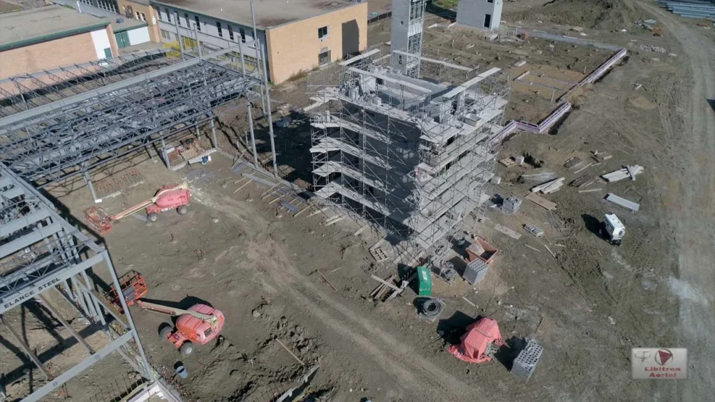
Long before the drone leaves the ground, the mission is meticulously planned. This involves defining the specific areas of interest, such as a new roof on a Bridgeland infill or the entire grading plan for a Seton development. The flight path is plotted using mapping software to ensure complete coverage with no missed spots.
The planning phase also includes a thorough safety and regulatory check. This means verifying no airspace restrictions apply near the Calgary International Airport corridor and securing any necessary site permits. A good plan anticipates on-site obstacles like cranes and ensures the entire flight is compliant and efficient.
On-Site Aerial Data Capture
On the day of the flight, a certified pilot conducts a final visual site assessment. They check for last-minute hazards, confirm weather conditions are safe for flight, and set up ground control points if high-precision mapping is required. These points are physical markers with known GPS coordinates that “anchor” the aerial data to real-world locations, crucial for accurate earthwork calculations.
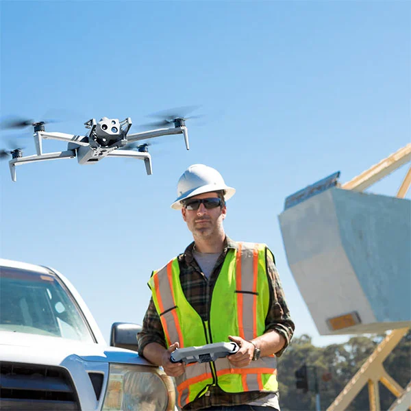
The drone is then launched, but the pilot is often more of a supervisor than a manual flyer. The aircraft follows the pre-programmed flight path autonomously, capturing hundreds of overlapping high-resolution photos and 4K video from precise angles. This automation ensures consistency and eliminates human error in data collection.
Flight Execution and Autonomous Flight
Modern drones like the Skydio 2+ use advanced obstacle avoidance systems, allowing them to fly safely in complex, cluttered environments. They can navigate around scaffolding, between structural beams, and under overhangs to capture close-up imagery that would be dangerous or impossible for a human inspector. This autonomy is key for repeatable, precise inspections over time.
During the flight, the pilot monitors battery levels, signal strength, and data capture in real-time. The mission can be paused or adjusted if an unexpected issue arises, but the goal is to let the automated system do its job. This method captures a comprehensive visual dataset far faster than any boots-on-the-ground walkthrough.
Post-Flight Data Processing
The raw photos and video are just the beginning. Back in the office, the data is uploaded to specialized photogrammetry software. This software stitches the thousands of overlapping 2D images together to create accurate 3D models, orthomosaic maps (geometrically corrected “map” views), and digital surface models.
The true value is unlocked in this digital reconstruction, turning simple pictures into measurable, interactive assets.
Many Calgary contractors now rely on aerial progress reporting with drones to capture consistent weekly site updates and visually compare progress across different construction phases.
Benefits of Drone Inspections for Construction Sites
Progress Monitoring and Timeline Comparison
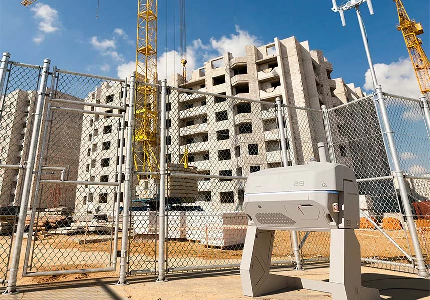
The most immediate benefit is crystal-clear progress tracking. Weekly or monthly drone flights generate a time-lapse series of the entire site. Project managers can compare current orthomosaic maps directly against the project schedule and architectural plans to see if foundation work in Beltline is on track or if framing in Evanston is lagging.
This visual history becomes an indisputable record. It helps settle disputes, provides proof of work completed for progress payments, and allows stakeholders anywhere in the world to virtually “walk” the site. You’re not relying on fragmented photos or subjective reports.
Safety Inspections and Hazard Detection
Drones provide a safe way to inspect high-risk areas without putting personnel in danger. They can closely examine unstable trenches, check the integrity of temporary structures after one of Calgary’s infamous hailstorms, or inspect rooftop mechanical units on a 20-story build.
This proactive safety tool can identify potential hazards like unsecured materials, improper scaffolding, or water pooling in excavations before they cause an incident. It’s a powerful layer of protection for every worker on site and a critical component of modern safety management.
Quality Control and Defect Analysis
High-resolution imagery allows for incredibly detailed quality checks. Superintendents can zoom in on individual concrete pours to check for honeycombing, examine weld quality on structural steel, or verify the correct installation of cladding panels. Thermal imaging drones can even detect moisture intrusion or insulation gaps invisible to the naked eye.
Catching these defects early, sometimes even before the next trade arrives, saves enormous amounts of time and money. It prevents costly rework down the line and ensures the finished building meets the specified quality standards from the ground up.
Material Management and Stockpile Tracking
Drones excel at inventory management. By flying over material stockpiles—like gravel, sand, or rebar—and using photogrammetry software, teams can calculate volumes with impressive accuracy. This prevents both shortages that delay work and over-ordering that ties up capital and space.
You can track how quickly materials are being used, plan just-in-time deliveries to congested inner-city sites, and reduce waste. For earthworks, comparing drone-generated elevation models before and after excavation gives precise cut-and-fill calculations, keeping grading contractors accountable.
Drone inspections are also useful for documenting residential construction projects. Homeowners planning backyard renovations can explore our guide to the top outdoor kitchen concrete slab providers when preparing the foundation for outdoor living spaces.
Construction Drone Inspection Workflow and Process

Mission Planning and Settings
The workflow starts with defining the “why.” Is this a progress flyover, a structural inspection, or a volumetric survey? The objective dictates every setting: flight altitude, image overlap, camera angle, and whether to use a standard, zoom, or thermal camera. For a detailed facade inspection in the Downtown Commercial Core, the settings will be vastly different than for a broad area survey of a new community in Livingston.
Using apps like DroneDeploy or Pix4D, the pilot draws a polygon over the area of interest on a satellite map. The software then automatically generates the most efficient flight path to capture the required data, calculating battery needs and flight time on the spot.
Optimizing Flight Parameters
Key technical parameters are fine-tuned for the mission. Front and side overlap (often 70-80%) is crucial for the software to match points between images and build accurate 3D models. Ground Sampling Distance (GSD) is adjusted to ensure each pixel represents the desired real-world size, balancing detail with flight efficiency.
For video inspections, parameters like flight speed, gimbal movement smoothness, and focus points are set to capture stable, cinematic footage that clearly shows the subject. Proper optimization means capturing exactly what’s needed in a single flight, avoiding costly return trips.
Before operating a drone over a construction site, pilots must follow drone videography regulations in Calgary and Alberta, including certification requirements and airspace restrictions established by Transport Canada.
On-Site Workflow Steps
The on-site process is methodical. After a safety briefing, the pilot performs pre-flight checks on the drone, batteries, and controllers. They then establish a secure take-off and landing zone clear of personnel and debris. Communication with the site superintendent is key to ensure all moving equipment is accounted for and workers are aware of the operation.
Marking Altitudes and Building Features
For inspections requiring precise measurements, key features or altitudes are often marked in the flight software. This could involve tagging the highest point of a crane for clearance checks or noting specific floor levels on a high-rise to segment the inspection data later. This step adds critical context to the raw visual data.
Time to Fly and Data Capture
With the plan loaded, the pilot initiates the autonomous mission. The drone takes off, ascends to its starting altitude, and begins its systematic capture. The pilot’s primary role is now to monitor systems, watch for unforeseen obstacles (like birds), and ensure the aircraft remains within visual line of sight as per Transport Canada regulations.
Data Processing and AI Analysis
Once captured, the data is downloaded and processed. This computational step can take several hours depending on the dataset size. The output is a suite of deliverables: the 3D model, the orthomosaic, elevation maps, and the volume reports.
Increasingly, artificial intelligence is applied to this data. AI algorithms can be trained to automatically detect safety protocol violations (e.g., missing harnesses), count objects like piles or pallets, or flag potential structural anomalies for further review by an engineer.
Reporting and Sharing Results
The final step is translating the data into actionable insights. This isn’t just a folder of images. A professional report from Storimatic will include annotated screenshots from the model, comparison sliders showing change over time, quantifiable measurements, and clear video highlights of any issues found.
These reports are typically shared via secure cloud platforms. Stakeholders can view interactive 3D models in their web browser, make their own measurements, and add comments directly to the model. It turns a one-way inspection into a collaborative review tool.
Applications in Construction
Site Surveying and Mapping
Drones have revolutionized initial site surveys. They can map hectares of land in a fraction of the time of traditional survey crews, producing highly accurate topographic maps. This is invaluable for planning earthworks, drainage, and site layout, especially on large, undeveloped parcels common in Calgary’s outer edges.
The resulting data feeds directly into CAD and Civil 3D software, allowing engineers and architects to design with real-world conditions in mind. This seamless integration from survey to design reduces errors and streamlines the entire pre-construction phase.
Structural Inspections
For both new construction and existing buildings, drones provide unparalleled access for structural assessment. They can inspect the underside of bridges, the exterior of tall buildings, and the condition of pre-cast concrete elements. In Calgary’s freeze-thaw climate, checking for concrete spalling or sealant failure on high-rise balconies is a perfect drone application.
Specialized sensors like LiDAR can penetrate light vegetation to map structural elements or create “as-built” models of complex industrial facilities. This data is critical for renovation projects where original drawings may be lost or inaccurate.
Compliance and Contract Verification
Drone footage serves as objective evidence for verifying contract compliance. Did the subcontractor install all the specified rebar before the pour? Is the erosion and sediment control properly maintained around the site perimeter as per City of Calgary bylaws? The aerial record provides clear answers.
This objective documentation is also essential for creating a historical archive of the construction process. It protects all parties by providing a clear, visual chain of custody for how the building was assembled, which is invaluable for future maintenance, warranties, or insurance claims.
What to Expect in a Drone Inspection Video

Visual Demonstration of Flights
A professional drone inspection video is more than a random fly-around. It should tell a story. Expect a mix of wide establishing shots that show the entire site context, followed by smooth, deliberate approaches to specific areas of interest. The footage will be stable (thanks to gimbal stabilization) and may include graphical overlays like arrows, circles, or text annotations highlighting key points.
The video will logically move through the site, perhaps following the construction sequence from substructure to superstructure. You might see side-by-side comparisons of the same area from different weeks, visually demonstrating progress or lingering issues.
Key Inspection Elements Covered
Look for the camera to focus on critical details. This includes close-ups of structural connections, surface conditions of materials, alignment of elements, and the state of temporary works. The video should clearly show what “good” looks like and, more importantly, clearly identify any deviations, defects, or safety concerns.
A high-quality deliverable will also incorporate data visualizations. This could be a thermal image inset showing a heat leak, a 3D model spinning to show all angles of a crack, or a plan view map with a progress percentage overlay. The goal is to make complex spatial data immediately understandable.
All commercial drone operations must comply with regulations set by Transport Canada, and pilots must check airspace authorization through NAV Canada, particularly when operating near Calgary International Airport.
Frequently Asked Questions (FAQ)
How much does a construction drone inspection cost in Calgary?
Costs vary based on site size, complexity, and data deliverables, but most Calgary projects range from $500 to $2,500 CAD for a single inspection. A simple progress flyover of a residential infill in Killarney would be at the lower end, while a detailed, multi-sensor survey of a large commercial site with AI analysis would be higher. Many firms offer subscription packages for regular monthly flights, which provide better value for long-term projects.
The key is understanding what’s included. A professional quote should break down costs for flight time, data processing, and the specific reports or models you’ll receive. It’s an investment that typically pays for itself by preventing a single major error or delay.
Is drone inspection legal on Calgary construction sites?
Yes, when conducted by a licensed Advanced Operations pilot from Transport Canada. Professionals carry liability insurance and follow strict regulations regarding flight near people, over built-up areas, and outside visual line-of-sight. They also handle all necessary site-specific permissions and airspace checks, especially for sites near the YYC airport or hospitals with helipads.
Reputable providers like Storimatic manage all the legal and safety logistics. As the client, your main responsibility is to ensure a safe launch/landing zone and communicate the flight schedule to your on-site team to keep everyone clear.
What’s the difference between drone photos and a full inspection report?
Drone photos are just raw data points. A full inspection report is the analyzed intelligence derived from that data. The report provides context, measurements, comparisons over time, annotations, and professional conclusions. Think of it as the difference between a pile of lumber and a finished house—one has potential, the other provides real value and function.
The report transforms beautiful aerial imagery into actionable project information you can use to make decisions, verify work, and communicate with your team and stakeholders effectively.
Can drone data be used with other construction software?
Absolutely. This is where the real power lies. Data from drone inspections can be exported in standard formats (like DXF, LAS, or OBJ) and imported directly into most common construction software. You can bring 3D site models into AutoCAD or Revit, compare point clouds in Bluebeam, or track progress in Procore or Autodesk Build.
This interoperability means the drone inspection isn’t a siloed activity. It becomes a live data stream that feeds directly into your existing project management and BIM workflows, keeping your entire digital project model current with reality on the ground.
| Term | What It Means | Why It Matters |
|---|---|---|
| Orthomosaic Map | A stitched, georeferenced aerial image that is corrected for lens distortion and terrain, creating a perfectly scaled “map” view. | Allows for accurate on-screen measurements of distances and areas, essential for tracking installed quantities and verifying plans. |
| Photogrammetry | The science of making measurements from photographs, used to create 3D models from 2D drone images. | Turns simple photos into quantifiable 3D data you can measure, section, and analyze, providing depth and volume. |
| Ground Sampling Distance (GSD) | The distance between the center points of two consecutive pixels as measured on the ground (e.g., 2 cm/pixel). | Defines the resolution and detail of your imagery. A smaller GSD means higher detail but requires more images and processing time. |
| Digital Surface Model (DSM) | A 3D representation of the earth’s surface, including all objects on it like buildings, trees, and equipment. | Crucial for cut/fill calculations, drainage planning, and visualizing the site with all above-ground features intact. |
Now that you know what to expect from a construction site drone inspection video, the next step is seeing it applied to your specific project. This technology moves you from reactive problem-solving to proactive project management, saving time, money, and stress.
For Calgary builders and developers, a detailed aerial perspective isn’t just a nice-to-have—it’s a fundamental tool for modern, efficient construction.
Ready to bring this clarity to your next site in Rocky Ridge or the East Village? The team at Storimatic specializes in turning aerial data into your project’s greatest asset. Reach out for a consultation and see exactly what a professional drone inspection can reveal for you.
Need professional drone inspections for your Calgary construction site?
Storimatic provides certified drone pilots, high-resolution aerial inspections, and detailed reporting for developers, contractors, and project managers across Calgary and Alberta. Contact our team today to schedule your next drone inspection and gain a clearer view of your project’s progress.

Written by
Jared Ho
Founder of Storimatic Studio in Calgary. Video production specialist for businesses, with a focus on the construction industry, delivering 150+ projects and 20M+ views for clients. Services include construction video production, corporate video, training video, brand storytelling, and aerial drone footage. Drone-licensed and on-site at every shoot.
Ready to turn this into a video that wins business?
View Calgary Construction Video Production →