

If you’re overseeing a new build in Seton or managing earthworks for a commercial site in Quarry Park, you know the headache of traditional progress reports. Climbing scaffolding, coordinating site visits, and interpreting muddy, static photos often creates more questions than answers. Aerial progress reporting with drones in Calgary is transforming how projects are documented, offering a clear, accurate, and surprisingly cost-effective bird’s-eye view. Let’s break down exactly what this technology means for your build and why a local expert like Storimatic is your best partner for the job.

Introduction to Drone Surveys and Progress Reporting
Drone surveys are far more than just taking pictures from the sky. They involve a systematic, automated capture of precise visual data across a site using Unmanned Aerial Vehicles (UAVs). This process creates a comprehensive digital record that can be measured, compared over time, and shared instantly with stakeholders. For progress reporting, this means moving from subjective descriptions to objective, data-driven updates that everyone can understand. It eliminates the “he said, she said” of project status and creates a single source of truth.
Traditional methods often miss subtle changes or require significant labour to measure stockpile volumes or track grading. A drone can cover acres of land in a single, pre-programmed flight, capturing every detail with centimetre-level accuracy. This isn’t just a fancy upgrade; it’s a fundamental shift in project management transparency. For Calgary’s fast-paced construction seasons, having this level of oversight can be the difference between finishing on budget and facing costly delays.
Benefits of Drone Technology for Construction Progress Monitoring
The primary benefit is undeniable visual clarity. Stakeholders from investors in Toronto to foremen on-site can see exactly what’s happening, reducing miscommunication and aligning expectations. Drone reports provide chronological proof of work completed, which is invaluable for verifying contractor invoices and managing change orders. This visual audit trail protects all parties and builds trust throughout the project lifecycle.
Safety receives a massive boost, as drones can inspect hard-to-reach or hazardous areas like tall structures, steep slopes, or active earthmoving zones without putting personnel at risk. They can also monitor site security and ensure compliance with safety protocols from a distance. This proactive approach to risk management is something Calgary contractors, especially those working on complex sites near the Bow River or in established communities with tight spaces, find incredibly valuable.
Cost Savings and Efficiency Gains
While there’s an initial investment in professional drone services, the return is substantial. Drone surveys drastically reduce the time needed for manual measurements and site inspections, freeing up skilled labour for more critical tasks. Accurate volumetric calculations for materials like gravel, topsoil, or demolition debris prevent both over-ordering and under-ordering, directly impacting your material budget.
Efficiency gains come from improved planning and issue identification. Catching a drainage problem or a foundation misalignment early from an aerial view can prevent exponentially more expensive fixes down the line. For a sprawling project in a new community like Livingston, the ability to quickly assess the entire site’s status in one go is a game-changing efficiency that pays for itself many times over.
Bottom line: the data from a single drone flight pays for itself by preventing just one minor scheduling error or material miscalculation.
For teams that want deeper visual documentation, understanding what to expect from a construction site drone inspection video helps clarify how aerial footage can reveal structural details, safety issues, and site progress from angles that traditional inspections often miss.
Aerial capture is not always the right tool, and weighing site photos versus video capture shows when each wins: immersive footage for large sites and remote stakeholders, structured photo reports for simple, low-cost compliance records.
Aerial Progress Reporting with Drones: Site Services
Professional drone services move beyond simple aerial photography to deliver actionable intelligence tailored to construction management. These services are structured to provide the specific data points project managers need to make informed decisions week after week. It’s about translating pixels into progress percentages, volumes, and verifiable milestones that keep the project moving forward smoothly.
Site Progress Shots and Timelapse Monitoring
Regular, scheduled drone flights capture consistent overhead shots of the entire site from the exact same positions and angles. This consistency is key. When these images are stitched together over time, they create a powerful timelapse video that visually compresses months of work into minutes. This is an excellent tool for marketing, investor updates, and celebrating project milestones.
More importantly, these progress shots allow for direct visual comparison. You can overlay an image from Week 4 onto an image from Week 8 to see precisely where foundations were poured, where framing has gone up, or where landscaping has begun. This eliminates guesswork and provides a clear, indisputable record of development phases, crucial for projects with multiple trade partners working in sequence.
Construction Site Reporting and Earthworks Tracking
Dedicated construction reports use drone data to answer specific questions: How much excavation is complete? Has the subgrade been prepared according to spec? Where are materials stockpiled? These reports often include annotated imagery, measurements, and status updates that integrate directly into project management software like Procore or PlanGrid.
Earthworks tracking is a standout application. Drones can rapidly calculate cut and fill volumes, track the movement of soil across a site, and verify that grading matches the engineering plans. For a major site servicing project in a hilly area like Springbank Hill, this level of precision ensures drainage and lot grading are executed correctly from the very start, preventing future foundation or landscaping issues.
Mapping, Site Logistics, and Volume Calculations
Before equipment even arrives, drones can create detailed base maps of the existing terrain. These maps are used to plan access roads, crane placement, material staging areas, and site offices—optimizing the flow of people and machinery to avoid bottlenecks. Efficient site logistics, planned from accurate aerial data, directly reduce wasted time and fuel.
Volume calculations for stockpiles of sand, gravel, or aggregate are performed with remarkable accuracy. This allows for precise inventory management and ensures you’re paying for exactly what you receive. No more estimating based on truck counts or rough measurements; you get a digital measurement you can bank on.
Think of drone services as your project’s high-definition, measurable memory and planning tool, all in one.
Aerial capture is one input to a broader practice: progress reporting videos for owners combine drone footage, timelapse and narration into short, regular updates that keep owners and site teams aligned between visits.
Drone Data Processing and Deliverables
Capturing the images is only half the story. The real magic happens in the processing, where thousands of individual photos are transformed into usable engineering and planning assets. This is where specialized software and expertise turn raw data into the deliverables that drive decisions. The outputs are tailored to the needs of architects, engineers, and project managers.
Aerial to AutoCAD and CAD Linework Processing
One of the most powerful deliverables is the conversion of aerial imagery directly into CAD (Computer-Aided Design) files. Specialized photogrammetry software can trace features from the orthomosaic (a stitched, scaled aerial map) to create accurate linework. This means existing conditions like building footprints, roads, trees, and utilities can be quickly digitized into a .DWG or .DXF file.
This process saves hundreds of hours of manual surveying and drafting. For renovation projects on older buildings in communities like Inglewood or Bridgeland, having an accurate as-built CAD drawing created from a drone survey is invaluable for planning additions, roof replacements, or landscape redesigns.
Photogrammetric Mapping and Orthomosaic Outputs
Photogrammetry is the science of making measurements from photographs. By processing overlapping drone images, software can generate a geographically accurate 2D map called an orthomosaic. Unlike a simple photo, an orthomosaic is corrected for lens distortion and terrain, meaning every pixel is in its true planimetric position.
This allows you to take direct measurements of distance, area, and perimeter right from the image. Need to know the exact square footage of a completed roof for shingles? Or the area of a parking lot for asphalt? The orthomosaic provides the answers instantly. It becomes the definitive visual map of your site at a specific point in time.
3D Models, Digital Terrain Models (DTMs), and Topographic Surveys
The pinnacle of drone data processing is the creation of three-dimensional models. Using the same image set, software builds a dense point cloud, which can then be textured to create a photorealistic 3D model of the site. This model can be rotated, sectioned, and explored virtually—perfect for visualizations and clash detection.
From this data, a Digital Terrain Model (DTM) is extracted, which represents the bare earth surface without buildings or vegetation. DTMs are essential for engineering design, hydrological modelling, and calculating earthwork volumes. For all intents and purposes, a drone-captured DTM provides the same data as a traditional topographic survey, but often faster, with more detail, and at a lower cost for large areas.
Applications Across Industries
The versatility of drone progress reporting means its value extends far beyond generic construction sites. Different industries have unique pain points that drone data elegantly solves. From pre-planning to final inspection, the aerial perspective provides insights that ground-based methods simply cannot match efficiently.
Services for Engineers, Planners, Surveyors, and Consultants
These professionals are the primary beneficiaries of precision geospatial data. Civil engineers use DTMs for drainage and grading designs. Planners use current-condition maps to assess development feasibility. Surveyors use drone-captured point clouds as a supplement or alternative to ground surveys for large, open areas. Environmental consultants monitor vegetation health and track changes to natural features over time.
Drone deliverables integrate directly into their existing workflows, providing a richer data foundation for their designs, reports, and recommendations. This collaboration allows for more informed decision-making from the very first stages of a project, reducing the risk of expensive redesigns later.
Construction, Engineering, Real Estate, and Infrastructure Projects
In heavy civil and infrastructure, drones monitor the linear progress of projects like roadway expansions, pipeline corridors, or new LRT lines. They track embankment construction, bridge pier placement, and right-of-way clearing with ease. For real estate developers, drones are indispensable for marketing off-plan properties, showcasing master-planned communities like Auburn Bay, and providing progress updates to pre-sale buyers.
Engineering firms leverage drone data for structural inspections of bridges, dams, and tall buildings, identifying cracks or displacements without expensive scaffolding. The common thread is the need for accurate, visual, and measurable documentation of assets and progress across vast or complex areas.
Drone documentation is also helpful for residential builds. Homeowners planning backyard renovations often research top outdoor kitchen concrete slab providers before beginning their outdoor construction projects.
Essentially, any project that benefits from seeing the big picture—and measuring it—benefits from drone reporting.
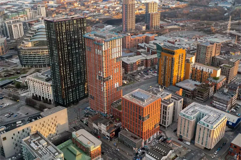
Aerial Mapping and Imagery
The foundation of all drone services is the imagery itself, but not all aerial imagery is created equal. Different sensors and techniques are deployed to answer specific questions, from “What does it look like?” to “Where is the heat escaping?” or “What’s beneath the canopy?”
High-Resolution Aerial Photography and Videography
This is the most common deliverable, but at a professional grade, it’s about more than a pretty picture. High-resolution cameras capture stunning detail, allowing viewers to zoom in and see individual roofing tiles, construction materials, or even cracks in pavement. This clarity is crucial for detailed inspections and creating marketing assets that truly impress.
Aerial videography adds the dimension of movement, guiding a viewer through a site or showcasing a property’s relationship to its surroundings, like a view of the Downtown Calgary skyline or proximity to the Glenmore Reservoir. When shot and edited professionally, this footage tells a compelling story about the project.
Thermal Imaging, Infrared Inspections, and LiDAR
Specialized sensors unlock entirely new applications. Thermal cameras detect heat signatures, making them perfect for identifying building envelope failures, missing insulation, roof moisture intrusion, or overheating electrical components. This is a powerful tool for building maintenance and energy audits.
LiDAR (Light Detection and Ranging) sensors use laser pulses to measure distance, creating extremely precise 3D models that can penetrate vegetation to map the ground surface below. This is critical for forestry management, floodplain mapping, and projects in heavily treed areas where photogrammetry alone can’t see the ground.
Orthomosaic Mapping and Contour Maps
As discussed, the orthomosaic is the workhorse 2D map. From this, contour lines can be automatically generated, showing elevation changes across the site. These contour maps are a staple of site planning and civil engineering, used for everything from designing sloping driveways to planning stormwater management ponds. Having this data on-demand accelerates the entire design and approval process.
All professional drone flights must comply with regulations set by Transport Canada and airspace approvals managed by NAV Canada, especially when operating near YYC Calgary International Airport.
Integration with Site Plans and Development

The true power of drone data is realized when it’s brought into the planning ecosystem. It acts as the perfect bridge between the real, existing world and the proposed, designed future. This integration reduces uncertainty and allows for proactive problem-solving before shovels ever hit the ground.
Overlaying Aerial Imagery on Existing Plans
Current orthomosaic imagery can be precisely overlaid onto existing CAD site plans or survey drawings in software like Google Earth Pro or GIS applications. This visual check quickly reveals discrepancies between what was planned and what actually exists. It might show an undocumented shed, a tree that’s larger than shown, or a property line marker that doesn’t align with the plan.
For contractors taking over a partially completed project, this overlay is a revelation. It provides immediate situational awareness, showing exactly what work has been done and what remains, directly against the original blueprint.
Planning Future Development and Identifying Obstacles
When planning new phases of development, drone maps of the current site are indispensable. Planners can digitally “place” proposed buildings, roads, and amenities onto the real-world aerial map to assess fit, sightlines, and access. They can identify potential obstacles like drainage swales, utility easements, or protected environmental areas that might not be obvious from ground level.
This foresight is crucial in Calgary, where respecting the natural landscape and adhering to community design guidelines is important. It allows for better community integration and can help streamline the development permit process with the City by providing clear, visual context for the proposal.
Integrating drone data with your plans turns static drawings into a dynamic, living model of your project’s past, present, and future.
Professional Drone Services in Calgary
Not all drone operators are equipped for professional progress reporting. The difference lies in licensing, advanced equipment, and methodological rigor. In Calgary’s regulated airspace, especially near the airport or hospitals, doing it right isn’t just about quality—it’s about legality and safety.
Licensed RPAS Pilots and FAA/Regulatory Compliance
In Canada, commercial drone pilots must hold a Transport Canada Advanced Operations Pilot Certificate. This ensures they understand complex air regulations, can perform flight planning in controlled airspace, and prioritize safety above all else. A professional service like Storimatic operates with full liability insurance and adheres to all NAV CANADA and City of Calgary bylaws.
They handle the necessary notifications for flying near landmarks like the Calgary Tower or in the flight paths around YYC Calgary International Airport. This compliance protects you from significant fines and legal liability, ensuring your project data is acquired legally and safely.
Equipment and Sensors for Precision Data Capture
Professional-grade drones, like the DJI Matrice series, are built for industrial use with longer flight times, greater stability in Calgary’s windy conditions, and the ability to carry multiple payloads. They use RTK (Real-Time Kinematic) or PPK (Post-Processed Kinematic) GPS for centimetre-level positioning accuracy without ground control points.
The sensors—from high-resolution RGB cameras to thermal and LiDAR modules—are calibrated and selected based on the project’s specific data requirements. This isn’t hobbyist equipment; it’s survey-grade technology that guarantees the accuracy and reliability of your deliverables.
Planning Drone Flights, Permits, and Shot Selection
Every professional flight begins with meticulous planning. Pilots analyze site location, airspace restrictions, weather forecasts, and the specific data goals to create a safe and effective flight plan. They determine the optimal altitude, image overlap, and camera angles to ensure the processed data meets the required specifications.
For projects requiring permits, such as those near helipads or in densely populated areas, they manage the application process. Their expertise in shot selection ensures the final imagery is not just comprehensive but also framed to best communicate the project’s status and highlights.
Before the first scheduled flight over a site, clear the regulatory side, because City permits are site-specific and take days to issue: drone flight rules in Alberta explain pilot certificates, controlled-airspace authorization and permits for Calgary sites.
Why Choose Drone Progress Reporting in Calgary
The combination of Calgary’s dynamic growth, challenging weather, and varied terrain makes drone reporting not just a luxury, but a strategic necessity. Whether you’re a homeowner adding a second story in Mount Royal, a contractor building a warehouse in Rocky View County, or a developer plotting a new community, the aerial advantage is clear. It provides transparency, enforces accountability, and delivers a depth of insight that keeps projects on track and on budget.
You gain an objective, visual record that protects your investment, facilitates clear communication with your entire team, and can even serve as powerful marketing material. In a competitive market, leveraging this technology demonstrates professionalism and a commitment to cutting-edge project management. The initial cost is quickly overshadowed by the savings in time, materials, and prevented errors.
Ready to see your Calgary project from the most informative angle possible? Storimatic brings local expertise and professional-grade technology to provide you with the clarity and data you need to build with confidence. Reach out today to discuss how aerial progress reporting can transform your next build.
For contractors who want scheduled aerial reporting without running a drone program in-house, Storimatic’s Calgary drone video production plans each flight, clears the airspace in advance and delivers repeatable progress footage for owners and investors.
Frequently Asked Questions
What is aerial progress reporting with drones?
It is the use of drones to capture regular aerial imagery and data of a construction site, giving owners and teams a clear, accurate view of progress over time.
How does drone progress reporting save money?
It replaces slow, manual site visits and ground photography with fast aerial capture, catching issues earlier and reducing delays, rework, and travel.
What deliverables come from aerial progress reporting?
Common outputs include progress photos and timelapse, orthomosaic maps, 3D models, volume calculations, and reports you can share with stakeholders.